In the studies carried out to determine the area where the 1071 Battle of Manzikert, known as the victory that led the Turks to first enter Anatolia, was fought, drones and magnetometers are used to detect war objects.
Conducting the field studies in the village of Gülkoru in the eastern province of Muş’s Malazgirt district, the team said this method, which is used extensively especially in the U.S., was used for the first time in Turkish archaeological studies to detect the battlefield.
“We have been carrying out studies in Malazgirt for three years, starting in June and continuing until the end of August,” said Professor Adnan Çevik, the scientific advisor to the excavations.
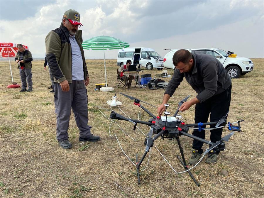
Stating that the works were restarted due to the use of the devices, Çevik said, “We had difficulties in scanning large areas, especially regarding the metal finds of the war. Thanks to this method, we will be able to view 2-3 meters below the ground with a scanning device integrated with a drone.”
The device, which is actually used for minesweeping, has been adapted to this type of archaeological work, he informed.
“With this method, we can scan large areas in a short time and detect metal objects left over from the war as this method is used to measure the amount of magnetism in the soil,” Çevik said.
This method will be very useful in terms of bringing a new methodology to battlefield archeology, according to the expert.
On Aug. 26, 1071, the armies of the Seljuk Turks and the Byzantine Empire clashed on the plain of Manzikert (Malazgirt) in what is now Muş.


