Piri Reis and his maps rediscovered
ISTANBUL - Anadolu Agency

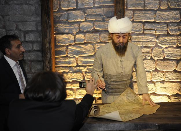
The Piri Reis map was drawn in 1513 by the Ottoman admiral. The approximately one-third of the map that survives shows the western coasts of Europe and North Africa and the coast of Brazil with reasonable accuracy. Various Atlantic islands including the Azores and Canary Islands are depicted, as is the mythical island of Antillia and possibly Japan. AA photos
Events are underway around Turkey in honor of the half-millennium since famous Ottoman maritime cartographer created a world map, with important exhibitions and collections scheduled for Istanbul.
“In this exhibition we can see something more than a map,” Culture and Tourism Minister Ömer Çelik
said in opening an exhibition at Istanbul’s Maritime Museum, adding that the exhibition also showed Turkish history and Turkish maritime history.
Noting that until today it had been difficult to say there were any strategic works concerning the seas, Çelik said it was essential for Turkey, a country surrounded by water on three sides, to use the sea more affectively. “All the political developments in the recent days such as the Arab Spring and developments in the eastern Mediterranean parts of the world show us how important the seas are for us.”
Significant figure in maritime historyPiri Reis was one of the most significant figures in the rise of the Ottoman Empire, Çelik said, adding that he was important both in the marine sciences and as a researcher.
Turkish officials have prepared a series of events within the scope of the celebrations and commemoration program.
The fact that UNESCO is remembering Piri Reis, who wrote his name in history for his contributions to world cartography, after 500 years is crucial in refreshing the world’s memory and remembering what Turks gave the world of science, he said.
Upon Turkey’s proposal, UNESCO included the 500th anniversary of Piri Reis’ world map in the 2013 celebrations and commemorations program for its 36th General Conference that was held in Paris in 2011.
The Piri Reis map was drawn in 1513 by the Ottoman admiral. The approximately one-third of the map that survives shows the western coasts of Europe and North Africa and the coast of Brazil with reasonable accuracy. Various Atlantic islands including the Azores and Canary Islands are depicted, as is the mythical island of Antillia and possibly Japan. The historical importance of the map lies in its demonstration of the extent of Ottoman exploration of the new world by approximately 1510.
The map was discovered accidentally in 1929 by German theologian Gustav Adolf Deissmann, who was commissioned by the Education Ministry to catalogue the Topkapı Palace library’s non-Islamic items.
Although Piri Reis was not an explorer and never sailed to the Atlantic, he compiled over 20 maps of Arab, Spanish, Portuguese, Chinese, Indian and older Greek origins into a comprehensive representation of the known world of his era. The work included the recently explored shores of both the African and American continents.
Çelik, meanwhile, also lamented the disappearance of past naval traditions, saying, “30 years ago, ships [waited] in front of Beşiktaş’s Barbaros Hayrettin Paşa grave and saluted it. This was a tradition. Now many traditions have been forgotten.”
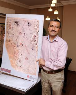
Kitâb-ı Bahriyye maps become a collectionMeanwhile, Piri Reis’ “Kitâb-ı Bahriyye,” made between 1521 and 1525, has now become a 40-piece collection.
The book was translated into Turkish upon the order of Mehmed II. Apart from the maps, the book also contained detailed information on the major ports, bays, gulfs, capes, peninsulas, islands, straits and ideal shelters of the Mediterranean Sea, as well as techniques of navigation and navigation-related information on astronomy, together with information about the local people of each country and city and the curious aspects of their culture. Antalya Maps and Cadastre manager Ramazan Eciş said the collection consists of 40 pieces.
The maps give people a look at the shores of Antalya shores 500 years ago, he said, adding that the pieces show how sociological and geographic changes affected the shores.
 The fact that UNESCO is remembering Piri Reis, who wrote his name in history for his contributions to world cartography, after 500 years is crucial in refreshing the world’s memory and remembering what Turks gave the world of science, he said.


