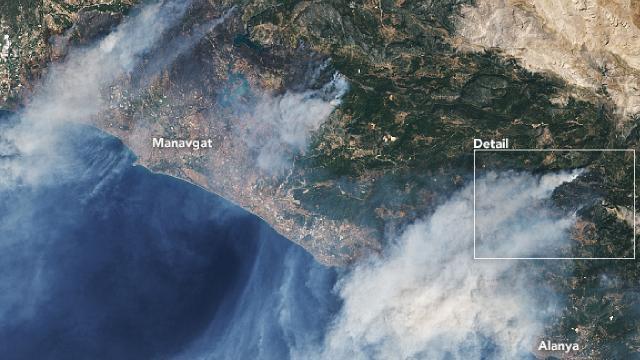
The U.S. National Aeronautics and Space Administration (NASA) has broadcast some satellite photos showing smoke rising from Turkey’s south and southwest, which have been battling raging wildfires over the past week.
“On July 31, the Operational Land Imager [OLI] on Landsat 8 acquired natural-color imagery of fires near [the southern province of] Antalya’s coastal districts of Alanya and Manavgat,” NASA said in a statement on Aug. 5.
NASA also photographed the situation in Muğla’s Marmaris district with its Aqua satellite.
“Much of southern Europe has been baking for weeks under extreme heat not seen since the 1980s. National temperature records were set in both Greece and Turkey in the past month,” NASA said.


