6.0-magnitude earthquake jolts Solomon Islands: USGS
SYDNEY - Agence France-Presse

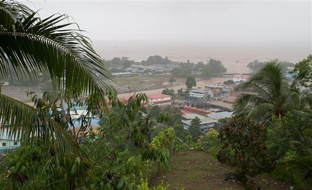
This handout photo taken on April 4, 2014 and released by World Vision shows flood waters in a street in the Solomon Islands' capital Honiara. AFP Photo
A strong 6.0-magnitude earthquake struck the Solomon Islands on Friday, the US Geological Survey said, but there were no immediate reports of damage.
The tremor, at a depth of 63 kilometres (39 miles), hit at 10.40 pm (1140 GMT), some 30 kilometres west of the city of Kirakira.
The US Geological Survey issued a "green alert", indicating there was a low likelihood of casualties and damage.
The Solomons are part of the "Ring of Fire", a zone of tectonic activity around the Pacific that is subject to frequent earthquakes and volcanic eruptions.
In February last year, the islands were struck by a major 8.0 magnitude quake that generated small but deadly tsunami waves which washed away houses and reached as far away as Japan.
In 2007 a tsunami following an 8.0-magnitude earthquake killed at least 52 people in the Solomons and left thousands homeless. The quake lifted an entire island and pushed out its shoreline by dozens of metres.