Maps by Piri Reis to be exhibited in Slovenia
PYRIAN - Anadolu Agency

Slovenia Prime Minister Alenka Bratusek (R) and Turkey’s ambassador to Ljubljana Serra Kaleli attend the opening reception of the exhibition.
An exhibition entitled “Piri Reis, the Cartographer of Sultan Süleyman” has opened at the Sergej Masera Maritime Museum in the Slovenian city of Pyrian.
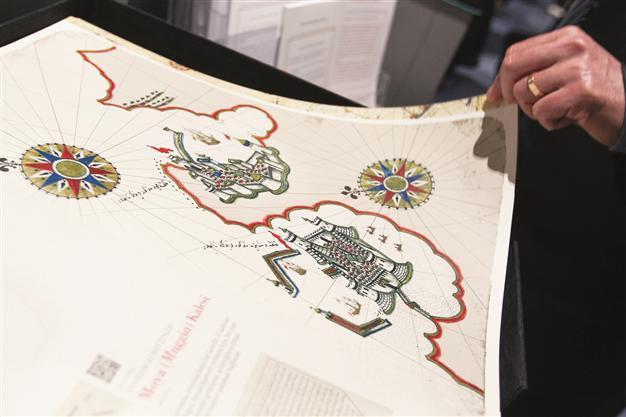
As part of the exhibition, visitors will have the chance to see some cities on the coast of the Adriatic Sea, as well as the 16th-century Mediterranean region through the eyes of Ottoman sailors.
Giving a speech during the opening, Slovenia Prime Minister Alenka Bratusek said the exhibition would contribute to the improvement of current relations between Turkey and Slovenia.
Turkey’s ambassador to Ljubljana, Serra Kaleli, said Piri Reis was the cartographer of one of the oldest maps of the American continent while adding that his maps had provided information about the people and culture of their region.
“His maps also show the Slovenian cities of Koper, Pyran and Izola. This is why the opening of such an exhibition here is very important,” Kaleli said.
Piri Reis is primarily known today for his maps and charts collected in his “Kitab-ı Bahriye” (Book of Navigation), a book that contains detailed information on navigation, as well as charts that were accurate for their time, describing the important ports and cities of the Mediterranean Sea.
The exhibition has been made possible by the Slovenian Culture Ministry, the Turkish Embassy in Ljubljana, the Turkish Underwater Archaeology Foundation (TINA) and Pyran Municipality.