Photogrammetric map of Iasos made
MUĞLA
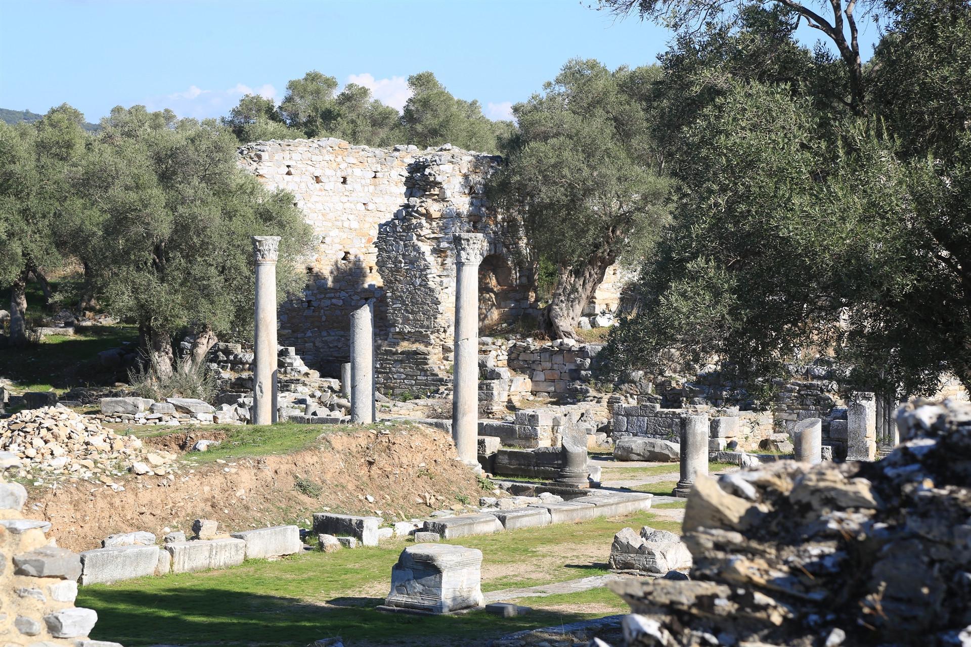
The ancient city of Iasos, a port city founded by the Argosians in the western province of Muğla’s Milas district, impresses visitors as it resembles an open-air museum with its great walls, aqueducts, agora, theater, Roman-era tombstones and fishermen’s market.
Archaeological excavations continue in the ancient city, which is located in the Kıyıkışlacık neighborhood.
The excavations in Iasos revealed that the oldest settlement in the city dated back to the end of 3,000 B.C. Within the scope of Iasos Excavations Support Protocol, shooting was done with a UAV1 class unmanned aerial vehicle in the area with special permission. The vehicle, which took off from the ancient city, covered 105 hectares of land in 36 minutes and transferred thousands of photos to digital media.
Speaking to the state-run Anadolu Agency, İsmail Ernur Öztekin, the deputy head of the excavations, said that it was possible to see the traces of Neolithic, Archaic, Hellenistic, Roman, Byzantine, Young Byzantine, Middle Ages, Menteşe, Seljuk and Ottoman periods in the ancient city of Iasos, which once was the gateway of the Caria Region to Europe during ancient times.
Öztekin stated that the 6,000-year-old ancient city was located approximately 26 kilometers northwest of the ancient city of Mylasa, which was called the Caria region in ancient times.
“This place was discovered by travelers in the 19th century. In the 1960s, an excavation team from Italy started archaeological studies with systematic excavations here. Currently, the studies are being carried out by Professor Asuman Baldıran from Selçuk University,” he added.
Aerial images transferred to digital media
Emphasizing the importance of documentation as well as excavations, Öztekin noted that in this context, the images of the ancient city were transferred to the digital environment thanks to an unmanned aerial vehicle.
Stating that they are working using the traditional archaeological techniques, Öztekin said: “It was a special day for the ancient city of Iasos. An area of 105 hectares was photographed from the air and the region was digitized scientifically. With a system called Geographical Information System, this data will be processed in the computer environment. Thanks to the digital infrastructure we have obtained, we will be able to use the topography of the ancient city of Iasos, its architectural structures and the physical formations of the region and use them in our future studies.”
Expressing that the infrastructure was prepared especially for tourism with aerial scanning, Öztekin said that they aim to contribute to the promotion of the ancient city and the economy of the region with the visitor reception centers and walking routes that will be designed and restoration projects that will be carried out on the monuments.
Turgay Kınacı, an engineer of geodesy and photogrammetry, stated that they carried out the aerial photography work on a voluntary basis to support archaeology, noting that they produced digital photogrammetric maps of the ancient city and its surroundings.
Kınacı stated that they used an unmanned aerial vehicle for the first time in such a project, adding, “This map production was not implemented in other archaeological projects before. This technology is normally used in mining, city planning and map production.”
Kınacı stated that the data obtained will contribute to the field of archaeology.